PPAS Mountain Resources
Pikes Peak Resources
Current Weather on Pikes Peak
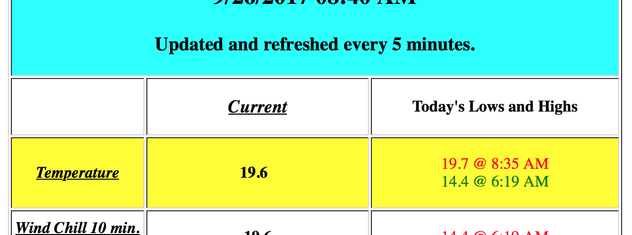
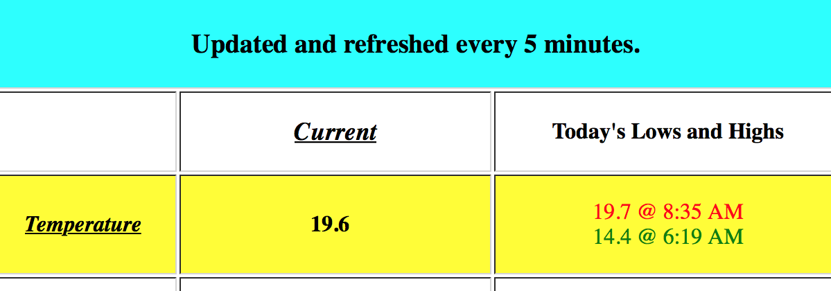
Summit Weather Station info here
This station is susceptible to the mountain weather and can often be out of order.
- When the wind speed shows zero, question it. The anemometer is likely frozen.
- Check the date of last reading to insure data is current.
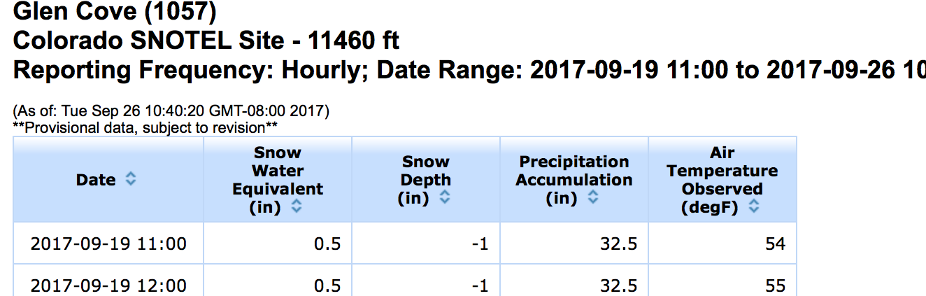
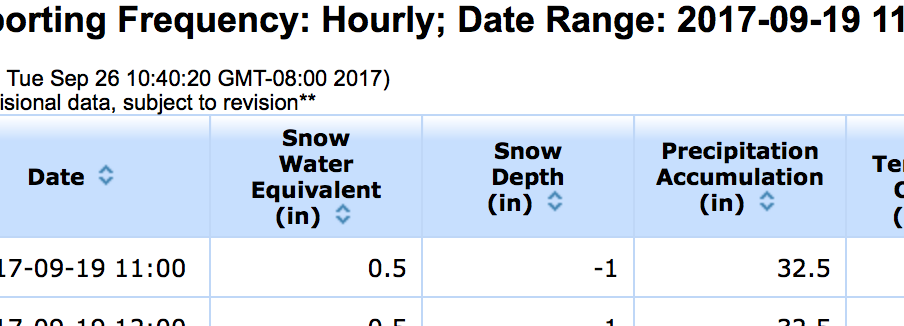
Glen Cove SNOTEL (text)
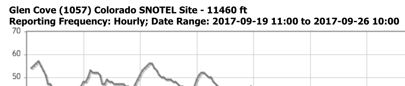
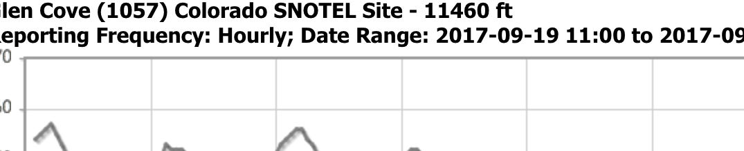
Glen Cove SNOTEL (graph)
Snotel info here
This remote Snow Telemetry station measures snowpack and temperature data and is protected from the wind. Measured is Temperature, Snowpack depth and Snowpack Water Equivalency (how much water the snow would melt down to)
- Check the date of last reading to insure data is current
- Sometimes when it is actively snowing the snowpack depth will read zero
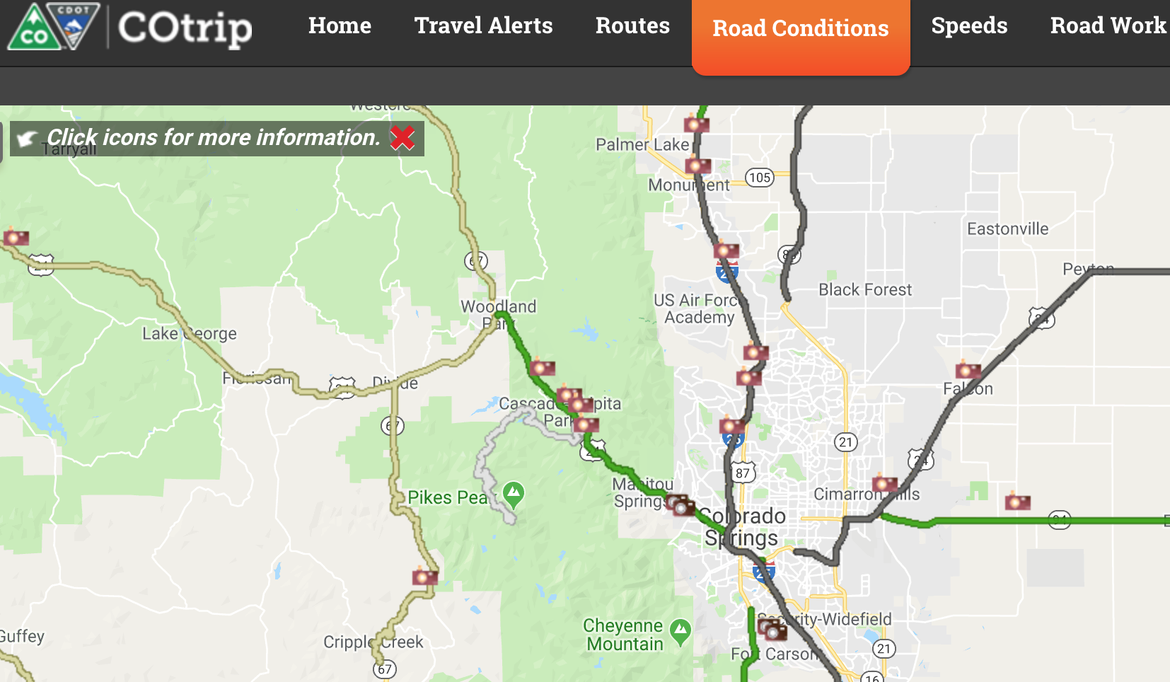
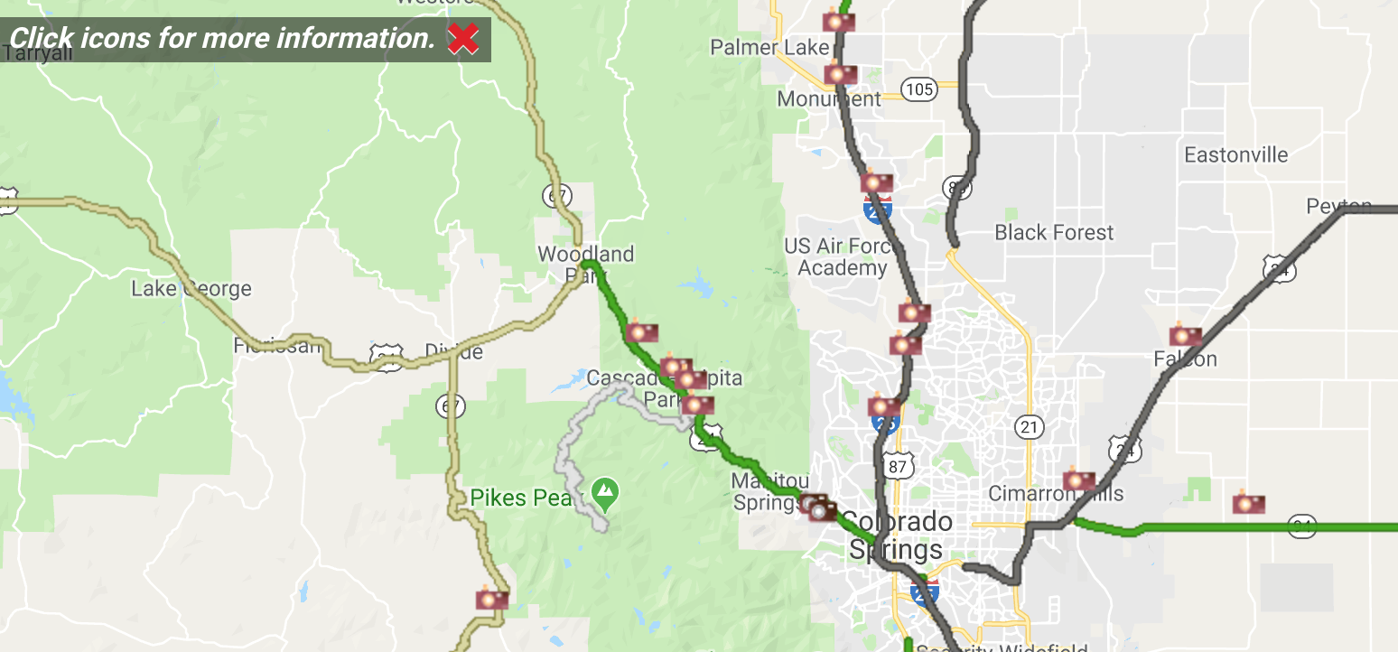
Pikes Peak web cams
Check date stamp on images, they are not always current.
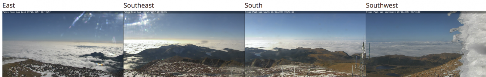
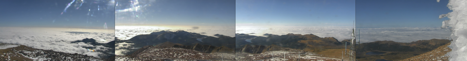
Summit web cam (multi directional)
Other web cams
Weather Forecasts on Pikes Peak
Elevation (13,750′)
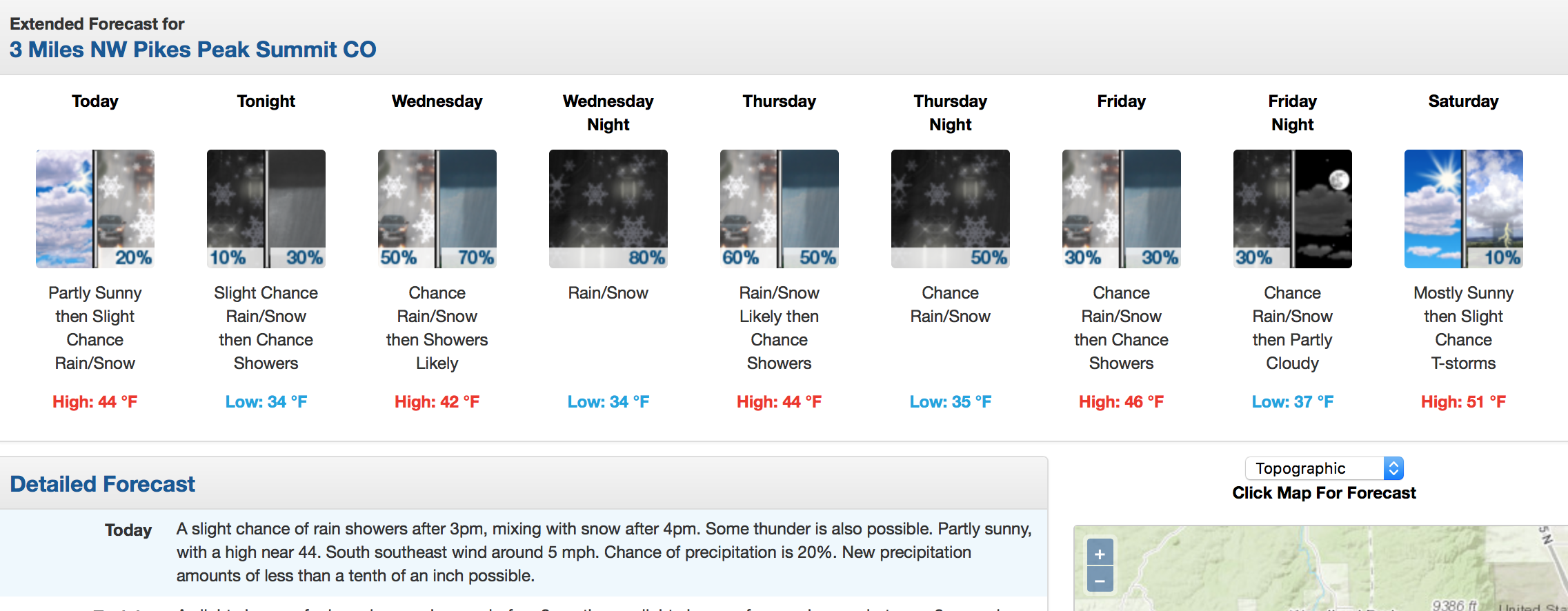
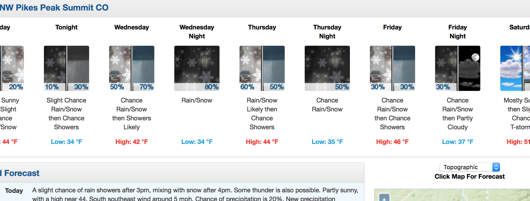
Summit, NOAA point forecast (text)
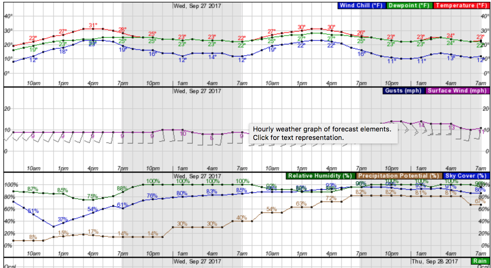
Summit NOAA point forecast (graph)
Elevation (11,198′)
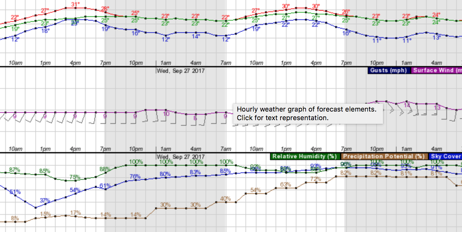
Glen Cove NOAA point forecast (text)
Forecast Discussion the for Pikes Peak Region
Glen Cove NOAA point forecast (graph)
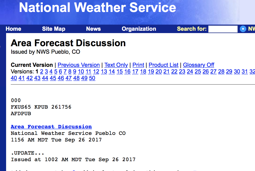
Forecast Discussion info here
These weather discussions are local forecasters giving the point forecasts (above) value. They help to inform us what they are seeing in the computer run models and were the models tend to exaggerate or underestimate potential.
- There are three discussion areas throughout Colorado (Pueblo is our local area forecast center)
- Z or Zulu is equivalent to UTC (universal) time. For Colorado, the conversion is -7 hours in the winter and -6 hours during daylight savings time.
CAIC Weather Models & Stations
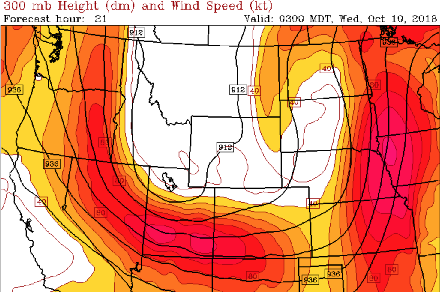
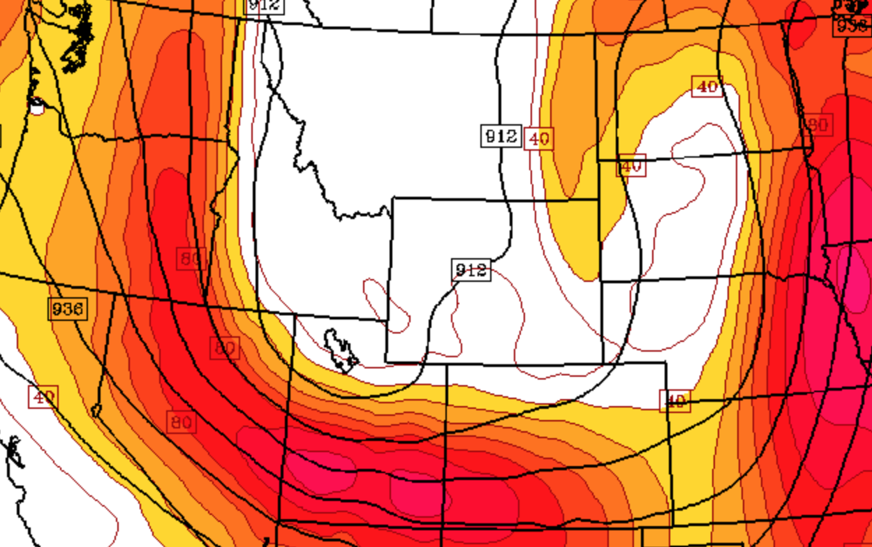
CAIC Models info here
The Colorado Avalanche Information Center has tailored these weather forecasting models to be useful in tracking and predicting temps, wind, precipitation and more.
- Default model is CAIC WRF
- Models run every 6 hours for an 84 hour span
- Usually choose the most recent model, if it shows less than 84 hours, computers are currently running the model
- 700mb Ht-T-RH (Temps and Relitive Humidity at ~10,000′)
- 700mb Ht-Wind (Wind at ~10,000′)
- 300mb Ht-Wind (jet stream)
Upcoming Public Courses


Gym to Crag Course, May 15-16 (Friday-Saturday)


4-Day Mountaineering Course, May 22-25 (Friday-Monday)

Trad Climbing and Anchors Course, June 6-7 (Saturday-Sunday)
SERVICES
Rock Climbing
Ice Climbing
Backcountry Skiing
Alpine Ascents
Expeditions
Avalanche Training
CONTACT
10618 County Rd 128
Poncha Springs, CO 81201
(719) 368-9524
info@PikesPeakAlpineSchool.com
For News and Course Info


Pikes Peak Alpine School operates under special use permits from the USDA Forest Service and is an equal opportunity service provider & employer
